

-
Weatherdawgs, how's it looking for Tuesday/Wednesday
Hey guys always appreciate your info and value your opinions! What's this severe threat for Tuesday/Wednesday looking like? SPC seems to be pretty concerned about it. Thanks for all y'all do!
-
I stole the grand baby from Mississippi this morning. She's up here with me for a while. I need some snow!! What y'all got weather dawgs???!!!?!!!
-
I want to be excited for this event, but I can't. Especially for the northern half of the state. Everything I am seeing is limiting instability to LA and the southern half of MS. I just haven't seen anything that blows my skirt up for AR and the western delta of MS. That said, instability is the only thing lacking for those areas as wind shear will be more than sufficient. A lot of times models will under perform on moisture return so it could end up being more than it appears now. The mid range models are just now picking up on the first half of the event and right now they're keeping moisture and instability confined down south. The SPC is still confident, though, so I'm not one to argue with them. But if I had a gun to my head and asked my opinion, I would say this will be primarily confined to LA south of I-20 on Tuesday and shift into central and south MS into Wednesday with Tuesday looking to be the worst day. Again, all subject to how robust moisture return will be to fuel instability.
-
Thanks, SVD! As usual we are in the shooting gallery here in Jones county lol! Appreciate the info!
-

Originally Posted by
starkvegasdawg

I want to be excited for this event, but I can't. Especially for the northern half of the state. Everything I am seeing is limiting instability to LA and the southern half of MS. I just haven't seen anything that blows my skirt up for AR and the western delta of MS. That said, instability is the only thing lacking for those areas as wind shear will be more than sufficient. A lot of times models will under perform on moisture return so it could end up being more than it appears now. The mid range models are just now picking up on the first half of the event and right now they're keeping moisture and instability confined down south. The SPC is still confident, though, so I'm not one to argue with them. But if I had a gun to my head and asked my opinion, I would say this will be primarily confined to LA south of I-20 on Tuesday and shift into central and south MS into Wednesday with Tuesday looking to be the worst day. Again, all subject to how robust moisture return will be to fuel instability.
Don't know about you guys, but I certainly hope it underperforms for precipitation. We've had enough rain in the past two weeks to last for two months.
-
Originally Posted by
DownwardDawg
I stole the grand baby from Mississippi this morning. She's up here with me for a while. I need some snow!! What y'all got weather dawgs???!!!?!!!
I'll tell you right now nobody on this planet wants snow more than me. There's been some hints of a possible dusting here and there, but nothing I'll get my hopes up over.
-
Thanks SVD for all you do. I'll take the snow anytime over severe weather.
-
Originally Posted by
yjnkdawg
Thanks SVD for all you do. I'll take the snow anytime over severe weather.
Amen to this!
-
Originally Posted by
starkvegasdawg
I want to be excited for this event, but I can't. Especially for the northern half of the state. Everything I am seeing is limiting instability to LA and the southern half of MS. I just haven't seen anything that blows my skirt up for AR and the western delta of MS. That said, instability is the only thing lacking for those areas as wind shear will be more than sufficient. A lot of times models will under perform on moisture return so it could end up being more than it appears now. The mid range models are just now picking up on the first half of the event and right now they're keeping moisture and instability confined down south. The SPC is still confident, though, so I'm not one to argue with them. But if I had a gun to my head and asked my opinion, I would say this will be primarily confined to LA south of I-20 on Tuesday and shift into central and south MS into Wednesday with Tuesday looking to be the worst day. Again, all subject to how robust moisture return will be to fuel instability.
I'm excited you aren't excited.
-
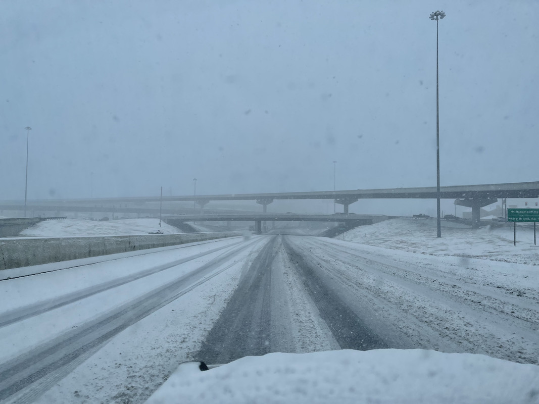
Downtown Nashville this past January. More of this please!!!
-
Originally Posted by
DownwardDawg
I stole the grand baby from Mississippi this morning. She's up here with me for a while. I need some snow!! What y'all got weather dawgs???!!!?!!!
We already had that in November. You all can take it the rest of the winter
-
00z run of the NAM is in and still not impressed. Southern LA is getting a good mix of parameters for severe weather, but I'm just not seeing it right now for north of I-20. I've been wrong before. May be again here. But I'm not seeing anything now making me want to burn vacation time.
-
Originally Posted by
PGHBulldogBG
We already had that in November. You all can take it the rest of the winter
Lol. Living my whole life in Mississippi, I'm enjoying the snow in north Tennessee. It ain't nothing like Pennsylvania though!!!
-
Ok. Got to put something out there before you start seeing it all over social media. The latest GFS coming in now is showing accumulating snow for parts of MS around the 82 corridor next Monday (19th). The NWS National Blend of Models is showing a dusting on the 20th. Am I saying it is going to snow? Absolutely not. I never believe it's going to snow until I've watched flakes fall for at least an hour. This is the first run the GFS has shown snow. The NWS blend has hinted at a dusting a day or so now. If nothing else there is growing consensus of a pattern change at least bringing temps out of the upper 70's and back to more December like temps. Maybe no more swatting mosquitoes in the deer stand. And who knows? Maybe...just maybe we see a couple flakes before Christmas.
But with the gfs showing snow on just one run the hype sites will start pumping out posts of snowmageddon before Christmas.
-
Originally Posted by
starkvegasdawg
00z run of the NAM is in and still not impressed. Southern LA is getting a good mix of parameters for severe weather, but I'm just not seeing it right now for north of I-20. I've been wrong before. May be again here. But I'm not seeing anything now making me want to burn vacation time.
How's it looking for jones/jasper county? Thanks svd!
-
Originally Posted by
Commercecomet24
How's it looking for jones/jasper county? Thanks svd!
Maybe, but from what I'm seeing this is going to struggle to do much in MS as it looks now.
-
Originally Posted by
starkvegasdawg
Maybe, but from what I'm seeing this is going to struggle to do much in MS as it looks now.
Thanks, man!
-
Here is the latest from the SPC for Tuesday. The enhanced area is also now in a hatched tornado threat meaning a risk for EF2+ tornadoes. I just don't see what they're seeing, but please listen to them over me.
DADC0B33-676C-41A5-A24C-ADAC9D828389.jpg
-
Originally Posted by
DownwardDawg
Downtown Nashville this past January. More of this please!!!
Looks like the city was slow to clear the roads. Don't know about Tennessee, but here the State is responsible for clearing major roads (Interstates, US highways) and the city does other streets. The city does a lot better job than the state does.
-
Originally Posted by
RocketDawg
Looks like the city was slow to clear the roads. Don't know about Tennessee, but here the State is responsible for clearing major roads (Interstates, US highways) and the city does other streets. The city does a lot better job than the state does.
Yeah. The city did pretty good. This is actually I-65 headed into Nashville. It was a damn epic snow though. It was hard for them to keep up. It was just one of those times when I absolutely had to be out there or no way I would have been. My vehicle is built for that mess but it was everyone else I was worried about. People were sliding all over the place.
 Posting Permissions
- You may not post new threads
- You may not post replies
- You may not post attachments
- You may not edit your posts
-
Forum Rules
Disclaimer: Elitedawgs is a privately owned and operated forum that is managed by alumni of Mississippi State University. This website is in no way affiliated with the Mississippi State University, The Southeastern Conference (SEC) or the National Collegiate Athletic Association (NCAA). The views and opinions expressed herein are strictly those of the post author and may not reflect the views of other members of this forum or elitedawgs.com. The interactive nature of the elitedawgs.com forums makes it impossible for elitedawgs.com to assume responsibility for any of the content posted at this site. Ideas, thoughts, suggestion, comments, opinions, advice and observations made by participants at elitedawgs.com are not endorsed by elitedawgs.com
Elitedawgs: A Mississippi State Fan Forum, Mississippi State Football, Mississippi State Basketball, Mississippi State Baseball, Mississippi State Athletics. Mississippi State message board.


 Reply With Quote


