-
Something to watch in the tropics - TD 19 off FL
A tropical wave over the Bahamas has now been given a 70% chance to become a tropical system over the weekend. It could approach the Biloxi / NOLA area early next week as a minimal hurricane.
Last edited by ScoobaDawg; 09-11-2020 at 06:53 PM.
-
-
-
I just got home from Texas working the Hurricane, we still have Logistics sites setup in LC.
Here you go Cc24
Disturbance 44 is now located across the Bahamas. This disturbance is moving to the west at 15 mph. It is very disorganized and the environmental conditions are currently only marginally favorable at best for development. The trough looks to move into Florida from today into tonight and then into the eastern Gulf on Saturday before turning to the northwest into the northeastern Gulf from Sunday into Monday. Once the disturbance gets into the eastern Gulf, the environmental conditions are forecast to become more favorable. Therefore, the chance of tropical development is now 40 percent.
-

Originally Posted by
Commercecomet24

How minimal?
Here's how you find out. Take your pistol and a deck of cards.
Throw the cards in the air, shot a single card. Whatever that card is...will represent the last number of the wind speed. Now look for the next card you seeing face up.. the very next one. that's the first digit of the speed.
Then look for a Face card. Think Jack - Cat 1, and so on till Ace - Cat 4. If you get the joker card... well it is 2020 and you should just go back inside and know the world is ending.
-
But for real... this is what SVD is talking about... from last night. there are now 2 named storms (fish storms) and a chance of 4 more Tropical disturbances formed in next 5 days.
But the thing for the gulf to watch is the one right of east FL, it's now been upgraded to 70% in the last 2 hours.
-
One wind strength forecast had most of the models in the 70-85mph range, but until it actually forms and gets in the Gulf then nobody knows for sure. Working in our favor is it will have to go over FL which will do it no favors and then it won't have but s couple days over water. Working against us is that water is hot tub quality.
-
Originally Posted by
ScoobaDawg
Here's how you find out. Take your pistol and a deck of cards.
Throw the cards in the air, shot a single card. Whatever that card is...will represent the last number of the wind speed. Now look for the next card you seeing face up.. the very next one. that's the first digit of the speed.
Then look for a Face card. Think Jack - Cat 1, and so on till Ace - Cat 4. If you get the joker card... well it is 2020 and you should just go back inside and know the world is ending.
Does this just work for 2020 or all the time?
Are the results the same if all I have are Uno cards?
-
Invest 96L what could possible be Sally
First models have run. Euro brings it into the fl panhandle at 72 hours as a tropical storm and rides the gulf coast west into New Orleans after 3 days.
Ships models are showing borderline cat 1.
-
Originally Posted by
starkvegasdawg
One wind strength forecast had most of the models in the 70-85mph range, but until it actually forms and gets in the Gulf then nobody knows for sure. Working in our favor is it will have to go over FL which will do it no favors and then it won't have but s couple days over water. Working against us is that water is hot tub quality.
Little shear either.. but yep... short amount of time to ramp up and deepen.
-
Originally Posted by
ScoobaDawg
Here's how you find out. Take your pistol and a deck of cards.
Throw the cards in the air, shot a single card. Whatever that card is...will represent the last number of the wind speed. Now look for the next card you seeing face up.. the very next one. that's the first digit of the speed.
Then look for a Face card. Think Jack - Cat 1, and so on till Ace - Cat 4. If you get the joker card... well it is 2020 and you should just go back inside and know the world is ending.
That forecast method seems shoddy to me. You are very likely to get conflicting results where your two digits for windspeed leave you with <100 mph winds but then pull a face card that describes a Cat 3 or Cat 4, whose lowest max wind speeds are >100mph. Just seems like an obviously bad model.**
-
Originally Posted by
ScoobaDawg
Here's how you find out. Take your pistol and a deck of cards.
Throw the cards in the air, shot a single card. Whatever that card is...will represent the last number of the wind speed. Now look for the next card you seeing face up.. the very next one. that's the first digit of the speed.
Then look for a Face card. Think Jack - Cat 1, and so on till Ace - Cat 4. If you get the joker card... well it is 2020 and you should just go back inside and know the world is ending.
That's funny I don't care who you are!
I've been keeping up with things on the nhc site and it seems like every time I check there's a new wave or disturbance. 2020 has been a witch!
-
Originally Posted by
Commercecomet24
That's funny I don't care who you are!
I've been keeping up with things on the nhc site and it seems like every time I check there's a new wave or disturbance. 2020 has been a witch!
Meh. I've been in the barrel 3 of the last 4 years starin' down storms like Lt. Dan. Bout time y'all MS Coast Rats take a turn.****
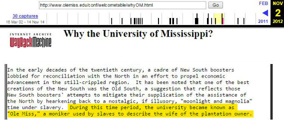
"After dealing with Ole Miss for over a year," he said, "I've learned to expect their leadership to do and say things that the leadership at other Division I schools would never consider doing and to justify their actions by reminding themselves that "We're Ole Miss.""
- Tom Mars, Esq. 4.9.18
-
Now a depression. Forecast is to remain a tropical storm and make landfall around Biloxi Tuesday afternoon.
-
Originally Posted by
BrunswickDawg
Meh. I've been in the barrel 3 of the last 4 years starin' down storms like Lt. Dan. Bout time y'all MS Coast Rats take a turn.****
We had our share!
Praise The Lord and Go Dawgs!!!
-
LA Nina is setup to stay... Tropics aren't gonna die off for a while longer... And gonna be a warm winter.
https://amp.usatoday.com/amp/3457447001
-
Originally Posted by
ScoobaDawg
Afraid you're right. Keep waiting for an El Ni?o to ramp up the spring severe weather season. La Ni?a can be a kick to the sack for that.
Guy on my chase team has read something from nhc where they were all but saying this will end up a hurricane. If it can come across FL reasonably intact I tend to agree.
-
Hey SVD give me a call on where you want to set up. Monday the Boat parade will be in full swing. Got the best site available to film it.
-
Originally Posted by
starkvegasdawg
Afraid you're right. Keep waiting for an El Ni?o to ramp up the spring severe weather season. La Ni?a can be a kick to the sack for that.
Guy on my chase team has read something from nhc where they were all but saying this will end up a hurricane. If it can come across FL reasonably intact I tend to agree.
Very much depends what happens over likely next 12-24 hours. The llc is very far north of the convection and the mlc. If the mlc pulls itself down to the surface, then the storm might stay offshore and go thru the straits of Florida. If that happens a lot more likely becomes a hurricane. Will have to deal with a good bit of shear for the next 24 hours.
-
Originally Posted by
parabrave
Hey SVD give me a call on where you want to set up. Monday the Boat parade will be in full swing. Got the best site available to film it.
Will do. As of now I am planning on being down. Probably leave Monday when I get off work. Probably means I'd miss the onset of tropical form storm winds. One thing of note...with the current track that would put the entire MS coast in the right front quadrant for a prolonged time so there will be a definitive tornado risk for a long time.
 Posting Permissions
- You may not post new threads
- You may not post replies
- You may not post attachments
- You may not edit your posts
-
Forum Rules
Disclaimer: Elitedawgs is a privately owned and operated forum that is managed by alumni of Mississippi State University. This website is in no way affiliated with the Mississippi State University, The Southeastern Conference (SEC) or the National Collegiate Athletic Association (NCAA). The views and opinions expressed herein are strictly those of the post author and may not reflect the views of other members of this forum or elitedawgs.com. The interactive nature of the elitedawgs.com forums makes it impossible for elitedawgs.com to assume responsibility for any of the content posted at this site. Ideas, thoughts, suggestion, comments, opinions, advice and observations made by participants at elitedawgs.com are not endorsed by elitedawgs.com
Elitedawgs: A Mississippi State Fan Forum, Mississippi State Football, Mississippi State Basketball, Mississippi State Baseball, Mississippi State Athletics. Mississippi State message board.


 Reply With Quote