

-
Here we go again - Wednesday severe threat
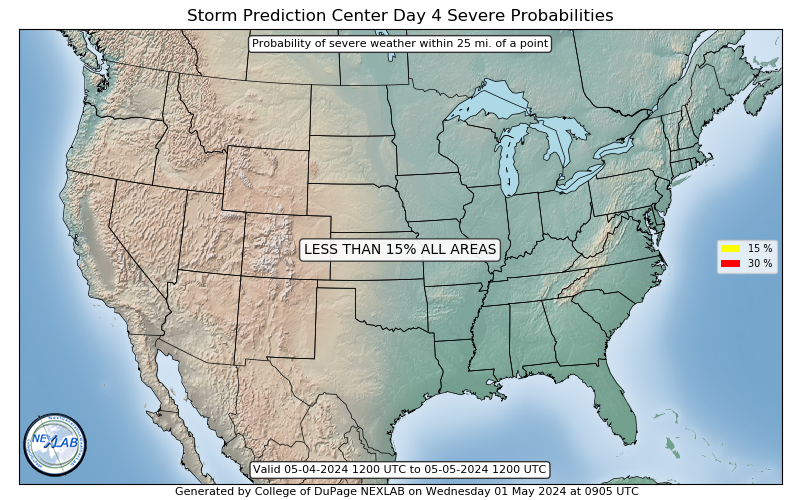
This one sort of came out of left field. The euro was showing it about 8 days ago and then it came out and the gfs never looked impressive. But times, as they say, are changing. SPC now feels confident of what looks to possibly be a significant severe weather event Wednesday as they have released a say four enhanced risk. They are also mentioning discrete supercells being possible along with a squall line. The supercells will have a risk for all severe weather modes including tornadoes. Early this afternoon after we get the 12z model runs in I'll take a look and see what they say.
-
Praise The Lord and Go Dawgs!!!
-
Don't like seeing these things as my Mom who is 78 lives in Jack Town.
thread hijack: I'm pissed that we here in Fort Worth will maybe miss a significant snow fall. I still carry a childhood love / fascination for snow. Have you guys in MS had any snow this year? get any last year? all we got was a very light dusting a little while back and a rain /sleet mix the other day. I've always thought the Dallas area has about the same chances for wintry weather somewhere between the chances of Jackson and Mempho.
-

Originally Posted by
OLJWales

Don't like seeing these things as my Mom who is 78 lives in Jack Town.
thread hijack: I'm pissed that we here in Fort Worth will maybe miss a significant snow fall. I still carry a childhood love / fascination for snow. Have you guys in MS had any snow this year? get any last year? all we got was a very light dusting a little while back and a rain /sleet mix the other day. I've always thought the Dallas area has about the same chances for wintry weather somewhere between the chances of Jackson and Mempho.
All we got in Starkville was a temporary light dusting back very early in the season. It's been several years since we saw what I call a real snow.
As for the severe and your mom in Jackson...right now just a wait and see on where the severe threat sets up and if it strengthens or weakens. Just make sure she follows these safety tips.
1. Have multiple ways to receive warnings. Best is a battery powered weather radio with SAME technology.
2. Keep your cell phone charged and on you at all times.
3. Know before hand where you will take shelter and make sure it is ready now.
4. Have people inside and outside your neighborhood know where you take shelter in your house. In the case of a direct hit they immediately know where to start looking.
5. If you will not be home during a severe event, let those same people know so nobody will waste time looking for someone that's not there.
6. Have a loud. police whistle or some other easily useable noise maker with you so you can signal for help. Key word here is LOUD.
7. Have a bottle of water with you in case you are trapped but still able to move your arms. You can have water with you to stay hydrated until help arrives.
8. Stay calm. The odds of taking a direct hit from a tornado, even on outbreak days, is very small. And even if you do, 99% of all tornadoes are only strong enough to take off a roof at most. The strong to violent tornadoes that reduce houses to slabs account for less than 1% of all tornadoes. That said, treat every warning as if one of those 1% tornadoes is on the ground and heading for you. Never assume it isn't there or will miss you.
Also, know the different types of warnings. Not all warnings are created equal.
1. Severe thunderstorm capable of producing a tornado. Lowest threat warning. Simply means radar has indicated a severe thunderstorm with tight rotation. A tornado may or may not be formed.
2. Severe thunderstorm producing a tornado. Means the NWS has strong reason to believe a tornado is currently on the ground but still no definitive proof.
3. Confirmed tornado. Means one has been seen by crazy people like me out chasing or confirmed on radar by the presence of a TDS or tornado debris signature.
4. PDS or particularly dangerous situation. The rarest of all warnings. Means a confirmed tornado has entered or about to enter a populated area.
Although the PDS warnings are rare. I was in two of them last week so they are issued.
One last thing. They will, on occasion, issue a PDS WATCH. This just means they expect very significant severe weather in the watch area. Again, these are very rare.
Last edited by starkvegasdawg; 02-09-2020 at 11:37 AM.
-
So the main question is where you going to be and will the live feed work?
-
thanks Vegas. I'll be talking to her later on today. Not sure how many years ago it was but she lives on Farnsworth and another home on Farnsworth got socked bad but her home was not damaged.
weird how naders can pop one home real close by but leave others undamaged.
-
Originally Posted by
parabrave
So the main question is where you going to be and will the live feed work?
Where I'll be is still to be determined. I'll be honest, what I'm seeing looking at the models is not impressing me severe wise. But I'm also not a degreed met like what the SPC has.
-
Originally Posted by
starkvegasdawg
Where I'll be is still to be determined. I'll be honest, what I'm seeing looking at the models is not impressing me severe wise. But I'm also not a degreed met like what the SPC has.
degreed or not, you are still a badass
-
Originally Posted by
starkvegasdawg
Where I'll be is still to be determined. I'll be honest, what I'm seeing looking at the models is not impressing me severe wise. But I'm also not a degreed met like what the SPC has.
Ask Scooba and the other owners if you can pin your live feed up top. That would be must click thread and it also let other posters see what you have to go through.
-
Originally Posted by
OLJWales
degreed or not, you are still a badass
I'm convinced there is a fine line between bad ass and crazy as hell.
-
Originally Posted by
parabrave
Ask Scooba and the other owners if you can pin your live feed up top. That would be must click thread and it also let other posters see what you have to go through.
That would be great if they wanted to. Of course right now it is just my twitter page @nmscasStan. Although, without saying too much, our chase team is working on something now that might change that. I'm not sure what it will or won't include yet as it's still in the developmental stages, but I hope to be able to share more sometime later this spring severe season.
-
I do enjoy following you. Is there anyway you can do a splitscreen with the different radars to let us know what you are looking at?
-
Originally Posted by
parabrave
I do enjoy following you. Is there anyway you can do a splitscreen with the different radars to let us know what you are looking at?
I don't think so. I'm still pretty low tech. My live stream camera my old iPhone. I can use my main phone and do screen shots of radar and maybe tweet them or hold my phone in front of my laptop radar.
-
Originally Posted by
OLJWales
Don't like seeing these things as my Mom who is 78 lives in Jack Town.
thread hijack: I'm pissed that we here in Fort Worth will maybe miss a significant snow fall. I still carry a childhood love / fascination for snow. Have you guys in MS had any snow this year? get any last year? all we got was a very light dusting a little while back and a rain /sleet mix the other day. I've always thought the Dallas area has about the same chances for wintry weather somewhere between the chances of Jackson and Mempho.
Don't know about Mississippi, but in the Huntsville area we had an inch or so in December, but only a trace a few times since then, including yesterday. Northeast Alabama had a couple inches yesterday morning. So not much here at all and it's 60 degrees today. Some flowering trees are actually blooming already.
-
Hey, what ever happened to Ref? Both y’all on the weather threads together was a beautiful thing.
-
Latest discussion from Jackson NWS office is strongly hinting that the severe threat from this system Wednesday will be downgraded. Just not looking as impressive to them.
-
Originally Posted by
starkvegasdawg
Latest discussion from Jackson NWS office is strongly hinting that the severe threat from this system Wednesday will be downgraded. Just not looking as impressive to them.
I’d like for em to miss one on the good side for a change.
-

Monday has now been upgraded to a slight risk for severe weather. The graphic above is the tornado threat area. Storms should and start training over the same areas. The southern boundary of these storms will be where the tornado threat is maximized. Peak timing should be early to mid evening. Still another couple hours before the Wednesday update is released.
-
Lots of warm, moist air moving up from the coast at a very fast pace. WPC predicting heavy rainfall across the NW part of the state tom.
-

SPC doubling down on Wednesday.
 Posting Permissions
- You may not post new threads
- You may not post replies
- You may not post attachments
- You may not edit your posts
-
Forum Rules
Disclaimer: Elitedawgs is a privately owned and operated forum that is managed by alumni of Mississippi State University. This website is in no way affiliated with the Mississippi State University, The Southeastern Conference (SEC) or the National Collegiate Athletic Association (NCAA). The views and opinions expressed herein are strictly those of the post author and may not reflect the views of other members of this forum or elitedawgs.com. The interactive nature of the elitedawgs.com forums makes it impossible for elitedawgs.com to assume responsibility for any of the content posted at this site. Ideas, thoughts, suggestion, comments, opinions, advice and observations made by participants at elitedawgs.com are not endorsed by elitedawgs.com
Elitedawgs: A Mississippi State Fan Forum, Mississippi State Football, Mississippi State Basketball, Mississippi State Baseball, Mississippi State Athletics. Mississippi State message board.


 Reply With Quote


