
-
Multi day severe weather event possible next week
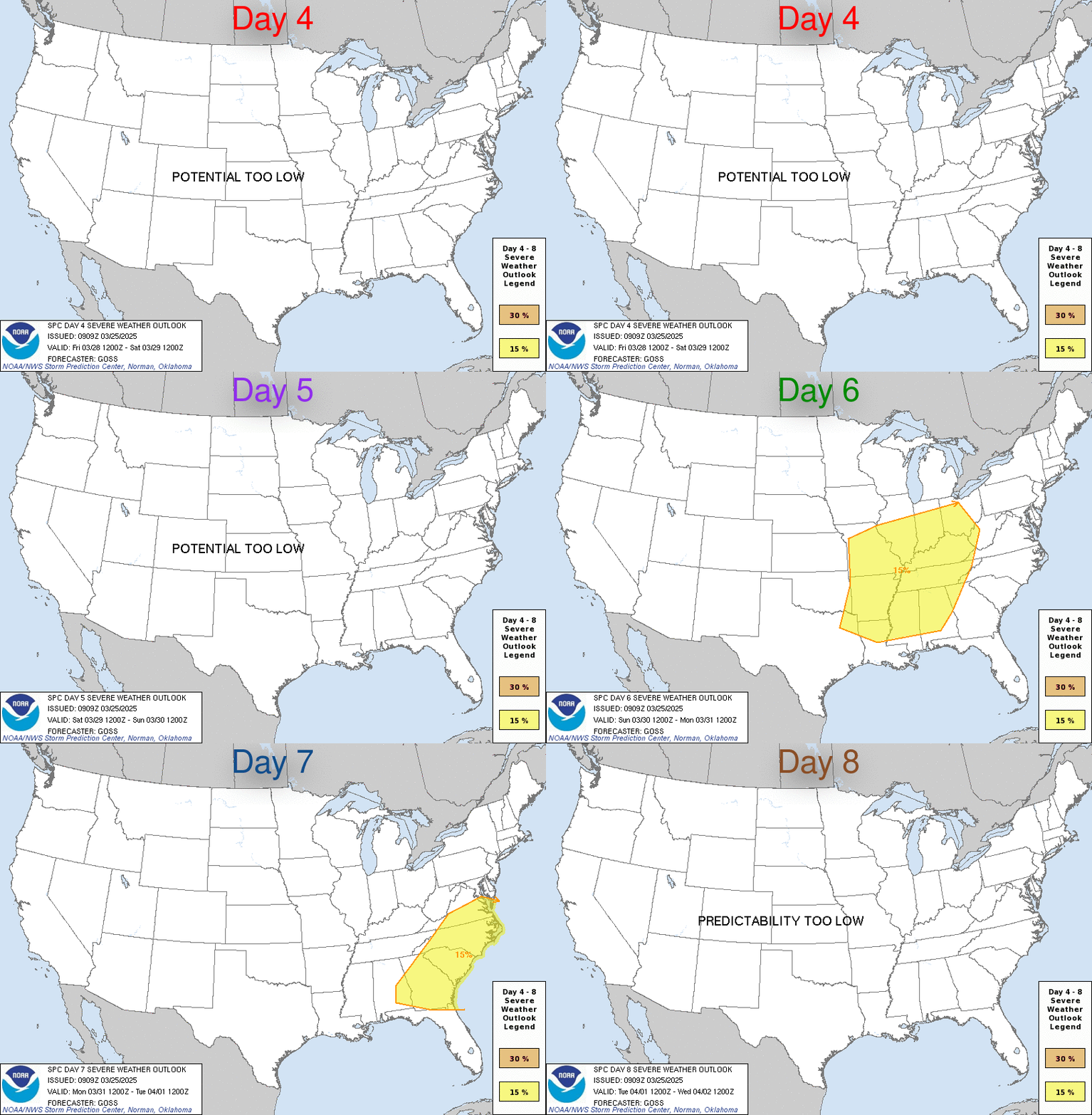
Next Tuesday and Wednesday could see some strong to severe storms as a series of storm systems cross the area. As things look now, this is setting up to be a typical winter low CAPE/high shear severe event. Typically, that would mean some strong straight line winds and a few tornadoes, but we're still too far out to start nailing down specifics. If the forecast holds, the time frame looks to be late Tuesday afternoon and night for the delta region and then transitioning to central and south MS late Monday night to the first part of Wednesday. The SPC has already issued day 5 and 6 threat outlooks below.

-
Isn't it pretty rare to issue threat outlooks that far out?
-
This weather is killing my baseball practice
-

Originally Posted by
PMDawg

Isn't it pretty rare to issue threat outlooks that far out?
Six days out isn't exceptionally common, but it's not rare. It will happen a few times a year. Seven days out starts to get uncommon. It may happen once or twice a year.
-
-
I nominate that Starkvegas gets his own Pinned thread at the top of the page. Especially with spring quickly approaching. Only requirement for him is to post his chase videos and they be narrated. What do you think Scooba?
-

Originally Posted by
parabrave

I nominate that Starkvegas gets his own Pinned thread at the top of the page. Especially with spring quickly approaching. Only requirement for him is to post his chase videos and they be narrated. What do you think Scooba?
I second the nomination.
-
Here is the latest from the SPC. For both Tuesday and Wednesday they have expanded the threat area. They also used a term that all chasers hate to hear...squall line. If that is true and holds expect main threat to be damaging straight line winds with the possibility of a few spin up tornadoes embedded in the line. In the next couple days the medium range models will start picking this system up and we'll have a better idea of what we're looking at.

-
Not much different to report. Timing still looking about the same with the delta region looking like overnight Tuesday and the rest of the state Wednesday afternoon. Starting to see some indications this may be more a squall line event which will be more straight line winds than tornadoes, but there will be enough shear for some line embedded tornadoes to be possible. That detail should be ironed out starting tomorrow as the medium range models start to cover the entire event. As of now still just a slight risk by the SPC. I wouldn't be surprised to see Wednesday end up enhanced for the eastern and southern part of the state and into AL.
-
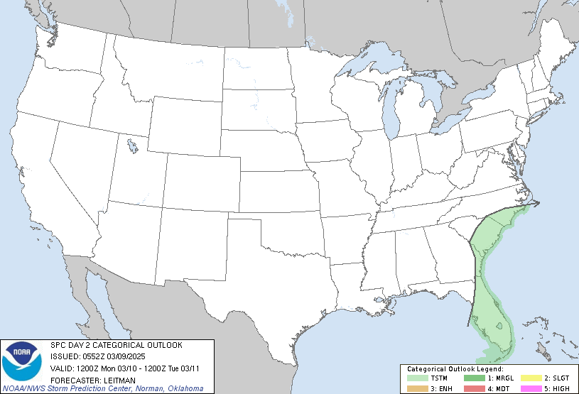
This is a good news / bad news update. The good news is that they've all but dropped the severe threat for today in the delta region. Most of north MS is under a marginal threat, but by and large most storms will stay under severe limits. Yesterday, they thought the same thing about Wednesday, but models were not in agreement. The bad news is today they're in better agreement and the severe threat has returned for Wednesday. As of right now this is for parts of MS basically south of the Natchez Trace. Another new development is the SPC now mentioning the threat for discrete supercell development out ahead of the front. While the entire threat area looks to be in this risk, I would place my bets on the biggest threat being the threat area between I-20 and Hattiesburg. Timing looks to be from late morning for the western zones and pushing into Sabanland by dark. This is still not looking like a high end event, but I do think we'll end up with a decent amount of severe reports.
Last edited by starkvegasdawg; 02-04-2020 at 06:37 AM.
-

Originally Posted by
starkvegasdawg

This is a good news / bad news update. The good news is that they've all but dropped the severe threat for today in the delta region. Most of north MS is under a marginal threat, but by and large most storms will stay under severe limits. Yesterday, they thought the same thing about Wednesday, but models were not in agreement. The bad news is today they're in better agreement and the severe threat has returned for Wednesday. As of right now this is for parts of MS basically south of the Natchez Trace. Another new development is the SPC now mentioning the threat for discrete supercell development out ahead of the front. While the entire threat area looks to be in this risk, I would place my bets on the biggest threat being the threat area between I-20 and Hattiesburg. Timing looks to be from late morning for the western zones and pushing into Sabanland by dark. This is still not looking like a high end event, but I do think we'll end up with a decent amount of severe reports.
Gulf storms/moisture could limit us over here in Alabama but models aren't doing a great job with consistency in that solution. This is one of those that probably needs to be an enhanced risk for us here, but it's not gonna be an in between. It's either gonna be kinda bad or it's gonna be no severe with a lot of rain.
Need more consistency today in a model solution that we can go forward with. Hope we get it.
-
We seem to be in a simlar pattern as last year and 2018, for feb.

Originally Posted by
starkvegasdawg

Next Tuesday and Wednesday could see some strong to severe storms as a series of storm systems cross the area. As things look now, this is setting up to be a typical winter low CAPE/high shear severe event. Typically, that would mean some strong straight line winds and a few tornadoes, but we're still too far out to start nailing down specifics. If the forecast holds, the time frame looks to be late Tuesday afternoon and night for the delta region and then transitioning to central and south MS late Monday night to the first part of Wednesday. The SPC has already issued day 5 and 6 threat outlooks below.

hate this weather
-
Bump. Any late Tuesday update??
-

Originally Posted by
DownwardDawg

Bump. Any late Tuesday update??
Was waiting for the evening model runs, but not much change. NAM may have trended slightly weaker but it was the less reliable midday run. The HRRR has lost its mind in storm severity, but I think it's drunk. All in all I'm still thinking about the same as I did this morning. Will update again later tonight when 00z model runs come in.
-
00z models look to be intensifying things. The forecast discussion from Jackson NWS also with a little more concern.
-

Originally Posted by
starkvegasdawg

00z models look to be intensifying things. The forecast discussion from Jackson NWS also with a little more concern.
Thanks man. Keep us updated. I’ll be checking this thread constantly.
-
Overnight, the SPC kept the slight risk for MS instead of upgrading to enhanced. They'll update again at 7:00am. We've already had one storm near Carthage go tornado warned this morning. The HRRR is still being very aggressive on showing today carrying a good tornado threat - especially in SW MS up to east central MS starting around noon. I'm not sure if that will verify as I am seeing some convection near the coast which may try to choke off instability making this far north. Right now it's just a waiting game to see what happens, but this is a day I'd prepare for it to be bad and then hope it doesn't happen.
-
Getting ready to head out. I hear Rolling Fork is pretty this time of year. Next SPC update is not for a couple hours so time to get some road under the tires.
-

Originally Posted by
starkvegasdawg

Getting ready to head out. I hear Rolling Fork is pretty this time of year. Next SPC update is not for a couple hours so time to get some road under the tires.
North of Long Beach about not a place to be in about one hour/
-
Enhanced risk upgrade for Central MS and NW AL. Came out on this new SPC update. Enhanced tornado risk along and 50 miles on either side of a line from roughly Vicksburg to Tupelo.
 Posting Permissions
- You may not post new threads
- You may not post replies
- You may not post attachments
- You may not edit your posts
-
Forum Rules
Disclaimer: Elitedawgs is a privately owned and operated forum that is managed by alumni of Mississippi State University. This website is in no way affiliated with the Mississippi State University, The Southeastern Conference (SEC) or the National Collegiate Athletic Association (NCAA). The views and opinions expressed herein are strictly those of the post author and may not reflect the views of other members of this forum or elitedawgs.com. The interactive nature of the elitedawgs.com forums makes it impossible for elitedawgs.com to assume responsibility for any of the content posted at this site. Ideas, thoughts, suggestion, comments, opinions, advice and observations made by participants at elitedawgs.com are not endorsed by elitedawgs.com
Elitedawgs: A Mississippi State Fan Forum, Mississippi State Football, Mississippi State Basketball, Mississippi State Baseball, Mississippi State Athletics. Mississippi State message board.
