
-
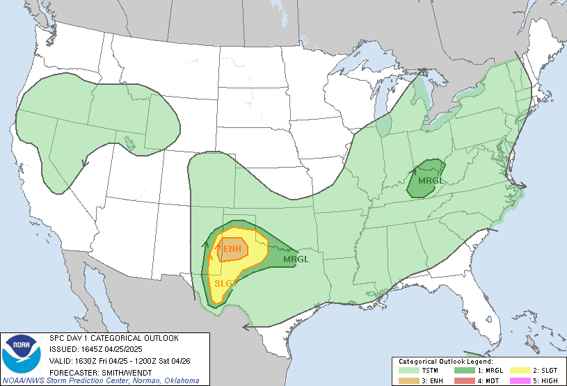
Quite understandable on not responding. I was near you some of yesterday. I started in Ackerman after a police officer there gave me permission to set up behind the hospital since it had a good view to the W and SW. I was going to just sit there and wait on the storm from Yazoo City. My patience ran out and I decided to meet it half way around Ethel or Kosciusko. By the time I got there the storm had really started losing steam and I saw another good hook down to my south heading to Louisville (I think we know how that turned out) so I made a mad dash down Hwy 9 to it. First and (I say) last time I ever punch a core trying to get to a tornado. That was not good for the nerves trying to make sure I didn't over drive and come out right in it's path. I ended up near the Wal-Mart there and watched it from a gas station with some chasers from CA. It was still obscured in rain for most of my viewing time since I was looking south from the edge of the core but it was close enough for me to hear the roar. I was then going to hit Hwy 14 and shoot across to Macon to set up on it again on 45ALT. but as soon as I did that the next storm just to its south went tornado warned and no sooner than I got out of town I looked up and that one was heading right at me. I was stuck there on the highway trying to decide if I just sit there and hope it misses me or try to outrun it through the hail core. After I remembered what I saw on I-40 while stuck in traffic outside Mayflower, AR, the day before I decided the hail core didn't sound too bad. I ended up finding a north running road just after getting in the core and took it so on that second storm I was less than a mile from the southern edge of the hook and the eastern edge of the hook. I have no doubts that country road has not seen many Dodge Rams going as fast as I was down that road trying to get north of of the circulation. After that I called it a day and headed back to the house. I didn't have a solid route to get me ahead of any more storms and the family was freaking out because the news kept saying a tornado near Starkville (evidently, Brooksville is near Starkville for TWC). They were nervous so I shut things down. After reading the latest from the SPC I am starting to get the bug to go out again today on something near the GT area. I work right by GTR airport so I have access to go south and east pretty easily.
-
Per Maroon Alert, Mississippi State's Starkville and Meridian campuses are closing today at 12:30 PM CDT due to the risk for severe weather.
B.S. Geosciences, Professional Meteorology Concentration, Operational Emphasis
c/o 2015
Mississippi State University
@Norwoodwx
Leicester City FC Owner
-
Senior Member

I'm just logging back on Ive been out helping with some cleanup in our area. However, while we were out the sun broke through...I told everyone around that was not good sign. I'm afraid this afternoon will not be fun!
-

Originally Posted by
DawgSaint

I'm just logging back on Ive been out helping with some cleanup in our area. However, while we were out the sun broke through...I told everyone around that was not good sign. I'm afraid this afternoon will not be fun!
I hope our forecast is wrong today. I pray it's wrong.
B.S. Geosciences, Professional Meteorology Concentration, Operational Emphasis
c/o 2015
Mississippi State University
@Norwoodwx
Leicester City FC Owner
-
Senior Member


No intent to brag here. The setup for this system was pretty obvious days in advance. Over at storm2k I posted this Friday morning at 10:
This event, IN MY OPINION, will be a non-event for most, if not all of the metroplex. The dry line will push to or just east of the I/35 corridor/metroplex Saturday night/Sunday morning when heating is gone, so I don't expect much at all from this event.
Louisiana, Arkansas, Mississippi & Alabama MIGHT see PDS tornado watches.
-

Originally Posted by
slickdawg

No intent to brag here. The setup for this system was pretty obvious days in advance. Over at storm2k I posted this Friday morning at 10:
This event, IN MY OPINION, will be a non-event for most, if not all of the metroplex. The dry line will push to or just east of the I/35 corridor/metroplex Saturday night/Sunday morning when heating is gone, so I don't expect much at all from this event.
Louisiana, Arkansas, Mississippi & Alabama MIGHT see PDS tornado watches.
Yeah...this was obvious. That's why SPC put out the outlooks so early for this one.
B.S. Geosciences, Professional Meteorology Concentration, Operational Emphasis
c/o 2015
Mississippi State University
@Norwoodwx
Leicester City FC Owner
-
Thanks for all the info you have supplied Ref and the video that you and Aaron put together. I'm sure glad Directv saw fit to bring TWC back. With TWC and WAPT Weather, I think we get excellent severe weather coverage in the Jackson Metro area. Shortly after those storms came across the river yesterday, they just exploded into tornadic super cells. I have the Red Cross Tornado App on my phone and that is real good for alerts as well as NOAA Weather Radio. No Meso discussion on Storm Prediction Center yet, but more than likely will be forthcoming. Prayers also go out to those who have been impacted by this severe weather.
-
Senior Member


Louisville tornado. Very close footage.
-
man, that's just crazy .... you related to the THRILLSEEKER from the Wayman Brothers ?
OXFORD, Miss. (WTVA) - Ole Miss campus police ask students to behave at future baseball games following a recent incident.
The university said students were reportedly throwing rocks at Georgia baseball players during last weekend's series.
-
Senior Member


The MODERATE area was expanded slightly westward, includes Jackson Metro now.

-
How about the new timing chart/map?
-
-

Originally Posted by
PassInterference

Yeah...Jackson's page will update you as much as possible.
B.S. Geosciences, Professional Meteorology Concentration, Operational Emphasis
c/o 2015
Mississippi State University
@Norwoodwx
Leicester City FC Owner
-
The timing chart doesn't appear as up to date at the chart Slick just posted. I suppose it is safe to assume about now through early evening.
-

Originally Posted by
PassInterference

The timing chart doesn't appear as up to date at the chart Slick just posted. I suppose it is safe to assume about now through early evening.
Pretty much.
B.S. Geosciences, Professional Meteorology Concentration, Operational Emphasis
c/o 2015
Mississippi State University
@Norwoodwx
Leicester City FC Owner
-
Here we go....Mesoscale Discussion is out saying a 95% possibility of a Tornado WATCH being issued for Central MS and Eastern LA.

B.S. Geosciences, Professional Meteorology Concentration, Operational Emphasis
c/o 2015
Mississippi State University
@Norwoodwx
Leicester City FC Owner
-
And I would like to say that none of my beloved weather apps were worth a shit yesterday except for Radar Scope (Google it).
I was disappointed in Weather Alert USA, the customizeable NOAA alert radio app. It didn't chrip a damn thing until hours after everything was over. Could have been cell phone network disruptions (who needs those...). Who knows.
-

Originally Posted by
PassInterference

And I would like to say that none of my beloved weather apps were worth a shit yesterday except for Radar Scope (Google it).
I was disappointed in Weather Alert USA, the customizeable NOAA alert radio app. It didn't chrip a damn thing until hours after everything was over. Could have been cell phone network disruptions (who needs those...). Who knows.
I use AlertFM. It's pretty good and will alert you when your GPS location is put under a warning.
B.S. Geosciences, Professional Meteorology Concentration, Operational Emphasis
c/o 2015
Mississippi State University
@Norwoodwx
Leicester City FC Owner
-
Storms already developing and intensifying over north LA between Monroe and Vicksburg. I agree with those that have said today won't touch yesterday but I don't think it's going to be a walk in the park either. I told myself I wasn't chasing today but I think I may have lied to myself this morning. I hate when I do that. Now the decision on whether or not to have my wife get my girl out of school early. If it didn't take a frigging hour for her to do the carpool thing it might be easier to do a wait and see approach. But once she is in carpool she is locked in line for the duration. If a tornadic storm or just one with large hail came through then she is just there to ride it out and large hail and moon roofs are not a good combination.
-
By the way. RadarScope is wonderful. My mom put it on her phone Sunday and she is scared to death of storms and woudln't chase if her life depended on it. I recommend it for anybody...chaser or not. Very nice to be able to pick out hail cores and storm rotation anytime you want and have to wait on the local news to get back to your storm when they are covering an entire region. Or when the damn NOAA tower is out where you live and your weather radio I have been harping on to anyone who will listen to buy is no more than a paper weight right now.
 Posting Permissions
- You may not post new threads
- You may not post replies
- You may not post attachments
- You may not edit your posts
-
Forum Rules
Disclaimer: Elitedawgs is a privately owned and operated forum that is managed by alumni of Mississippi State University. This website is in no way affiliated with the Mississippi State University, The Southeastern Conference (SEC) or the National Collegiate Athletic Association (NCAA). The views and opinions expressed herein are strictly those of the post author and may not reflect the views of other members of this forum or elitedawgs.com. The interactive nature of the elitedawgs.com forums makes it impossible for elitedawgs.com to assume responsibility for any of the content posted at this site. Ideas, thoughts, suggestion, comments, opinions, advice and observations made by participants at elitedawgs.com are not endorsed by elitedawgs.com
Elitedawgs: A Mississippi State Fan Forum, Mississippi State Football, Mississippi State Basketball, Mississippi State Baseball, Mississippi State Athletics. Mississippi State message board.


